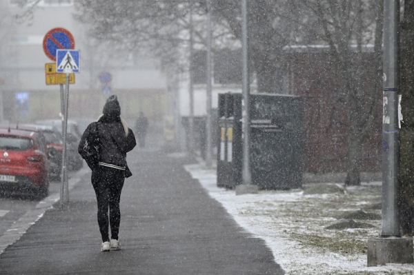

A person outdoors in Helsinki during snowfall. LEHTIKUVA
- Next Article Rovaniemi Airport to expand as tourist numbers surge
Finland is experiencing a sharp drop in temperatures as a cold northern air current brings snowfall across the country, including areas in the south.
Foreca meteorologist Anna Latvala said this week’s weather pattern marks a strong shift from the previous week, when temperatures exceeded 20°C in parts of the country.
“Last week’s warmth is only a memory,” Latvala wrote in Foreca’s weather blog. “There is no similar warmth in sight for the coming days.”
From Tuesday onwards, snowfall is affecting driving conditions in Lapland and Northern Ostrobothnia. Foreca forecasts 1 to 15 centimetres of snow accumulation over a 48-hour period, with the highest amounts expected in eastern Lapland.
In southern and central Finland, daytime temperatures are forecast to remain between 6°C and 12°C. Northern regions will see temperatures from 0°C to 6°C, with some areas in Northern Lapland remaining below freezing. Snow and sleet showers are possible as far south as the coastal regions.
On Wednesday, several precipitation systems are expected across Finland. A band of rain will move from the southeast along the eastern border into North Karelia, while scattered snow showers will spread across the north.
Snow accumulation is forecast at 5 to 15 centimetres in Central and Southern Lapland and parts of Koillismaa. In Northern Ostrobothnia and Kainuu, precipitation will vary between snow and rain. In the south and west, isolated showers are expected.
Latvala noted that despite a slight clearing of skies on Thursday, temperatures will remain low. Overnight lows could fall below freezing even in the south.
“Thursday night will be cold. There will be a few degrees of frost in southern inland areas, possibly even reaching the coast. In central Finland, temperatures will drop to –1°C to –6°C, and in the north –4°C to –10°C. Locally in Northern Lapland, it may drop below –15°C,” she said.
Friday night temperatures will also fall below zero across most of the country, with –5°C to –15°C expected in the north. Daily highs will remain modest, ranging from just above freezing in Lapland to 10°C in the south.
Light snow and rain showers will continue into the weekend, particularly in eastern regions and Lapland. A narrow band of snow is forecast to move from the north across Lapland on Friday, weakening as it moves south.
By Saturday night, sub-zero temperatures are again expected throughout Finland. In Lapland, overnight lows could range from –10°C to –15°C.
Forecasters say a change may be underway by Sunday, with winds shifting from the southwest. This could signal the end of the cold spell, though any increase in temperature will be modest.
“According to the current forecast, the wind may shift by Sunday, and cold air may begin to retreat,” Latvala wrote. “However, this is not yet reflected significantly in temperatures. In the south and centre, daytime highs will be around 5°C to 10°C, and in the north 0°C to 6°C.”
Uncertainty remains for weather during May Day week. Forecasts suggest a possible return to seasonal temperatures, but confidence is low.
“It’s too early to say whether May Day celebrations will require an umbrella, a winter coat, or sunglasses,” Latvala added.
HT
- Next Article Rovaniemi Airport to expand as tourist numbers surge
Source: www.helsinkitimes.fi